Methoni Castle
Co-ordinates:36°48′52.97″N 1°42′15.88″E
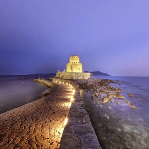
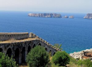
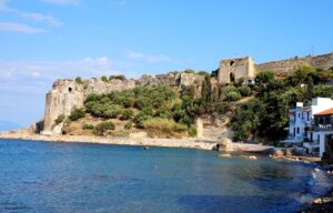
The Castle of Methoni is a medieval fortification in the port town of Methoni, Messenia, in southwestern Greece. The castle of Methoni occupies the whole area of the cape and the southwestern coast to the small islet that has also been fortified with an octagonal tower and is protected by the sea on its three sides.
Venetian Christian Church of Saint Leos or Saint Leon
Co-ordinates: 36.83767454573287, 21.724156969317956
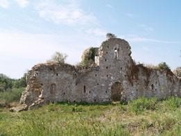
Northeast of Methoni in the area “Paliomethoni” are preserved the imposing ruins of the church of Agioleos. It is the katholikon of the Cistercian monastery of Santa Maria de Berge that was destroyed by the Greeks in 1267. It belonged to the type of three-aisled basilica, quite large, with strong walls with struts that supported the vaulted roof. To the east, the walls of the triangular sanctuary are preserved at a considerable height. The building preserves elements found in many temples in the West in the 13th century: the three prominent niches of the sanctuary, the strong struts on the four sides of the monument, the arrangement of two struts in its corners, the two double bases of columns on high pedestals in Inside contact with the western wall, the half-columns with tectonic undecorated capitals, as well as the former existence of a pillar at the main entrance gate on the west side, certify a unique example of pure Gothic architecture in the Messinian area. Later, in the 15th century, a smaller cross-roofed church was built inside the ruins of the large Gothic church, the ruins of which are preserved at a great height. Its transverse arch rested on four half-columns between which, in the north wall, there was probably an entrance. On the north and south walls, there were double glazed windows with a shield above them. The churchyard was fortified with struts.
New Navarino fortress
Co-ordinates:36°54′44.01″N 21°41′29.45″E
The fortress of New Navarino (Greek: ΝέοΝαυαρίνο; Ottoman Turkish: Anavarin-icedid) is an Ottoman fortification near Pylos, Greece. It is one of two castles guarding the strategic Bay of Pylos, on which it sits; New Navarino is located in the southern entrance of the bay, while the northern entrance is guarded by the 13th-century Old Navarino castle, built by the Crusaders of the Principality of Achaea. In juxtaposition with the latter, New Navarino is often known simply as Neokastro or Niokastro (Greek: Νεόκαστρο or Νιόκαστρο, “new castle”).[1]
Old Navarino castle
Co-ordinates:36.9585109362394, 21.657294140066316
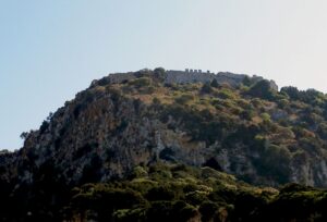
The Old Navarino castle (Greek: ΠαλαιόΝαυαρίνο) is a 13th-century Frankish fortress near Pylos, Greece. It is one of two castles guarding the strategic bay on which it sits; the other is the Ottoman-built New Navarino fortress. In juxtaposition with the latter, it is frequently known simply as Palaiokastro or Paliokastro (Greek: Παλαιόκαστρο or Παλιόκαστρο, “old castle”).[1] It occupies the site of the Athenian fort at the 425 BC Battle of Pylos.
Koronitown and Koroni Castle
Co-ordinates: 36°47′39.58″N 21°57′50.02″E
Koroni or Corone (Greek: Κορώνη) is a town and a former municipality in Messenia, Peloponnese, Greece. Since the 2011 local government reform it is part of the municipality Pylos-Nestoras, of which it is a municipal unit.[2] Known as Corone by the Venetians and Ottomans, the town of Koroni (pop. 1,397 in 2011) sits on the southwest peninsula of the Peloponnese on the Gulf of Messinia in southern Greece, 56 km (35 mi) by road southwest of Kalamata.[3
Palace of Nestor
Co-ordinates:37°1′37.37″N 21°41′41.41″E
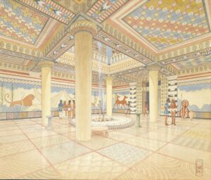
The Palace of Nestor (Modern Greek: ΑνάκτοροτουΝέστορα (Dimotiki); ἈνάκτορονΝέστορος[1] (Katharevousa)) was an important centre in Mycenaean times, and described in Homer‘s Odyssey and Iliad as Nestor’s kingdom of “sandy Pylos“.[2]
Voidokiliabeach
Co-ordinates:36°58’00.4″N 21°39’39.7″E
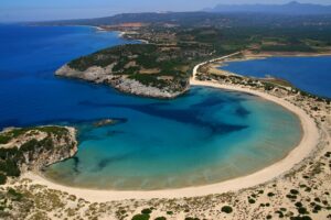
Voidokilia Beach (Greek: ΠαραλίαΒοϊδοκοιλιά, pronounced [voʝðociˈʎa]) is a popular beach in Messinia in the Mediterranean area. In the shape of the Greek letter omega (Ω), its sand forms a semicircular strip of dunes.
Gialova Lagoon
Co-ordinates:36°58’01.8″N 21°40’35.9″E
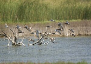
Gialova Lagoon (Greek: Γιάλοβα, pronounced [ˈʝalova]) – also known as Divari, from the Latin word vivarium, meaning “fishery” – is a brackish body of water in the municipality of Pylos-Nestor, Greece, about 8 kilometres (5.0 mi) north of Pylos.
Archaeological Museum of Chora
Co-ordinates:37.053717740360284, 21.72073318424801
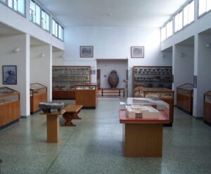
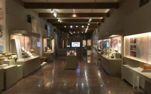
The Archaeological Museum of Chora is a museum in Chora, Messenia, in southern Greece, whose collections focus on the Mycenaean civilization, particularly from the excavations at the Palace of Nestor and other regions of Messenia.
Museum of Underwater Antiquities (Pasha Museum of Pylos Fortress)
Co-ordinates:36.91285515646547, 21.692233343001057
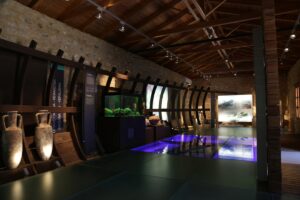
The Pasha’s building is situated on the external compound of the Ottoman Fortress of Pylos (Niokastro), where the settlement of the castle was. It is a rectangular, two-storied stone building dated to 17th and 18th century AD.
Archaeological Museum of Pylos
Co-ordinates:36.91285515646547, 21.692233343001057
The Museum of Pylos is located in the city centre and is accessible from the road leading to Methoni, on the right of the Three Admirals’ Square. You will see the museum on your right.
Polylimnio Waterfalls Road
Co-ordinates:36.98832468429675, 21.855600282395674
Polylimnio is located in the Prefecture of Messinia, in the community of Haravgi of the Municipality of Messina. It is a complex of lakes, which due to the uneven ground create waterfalls.

